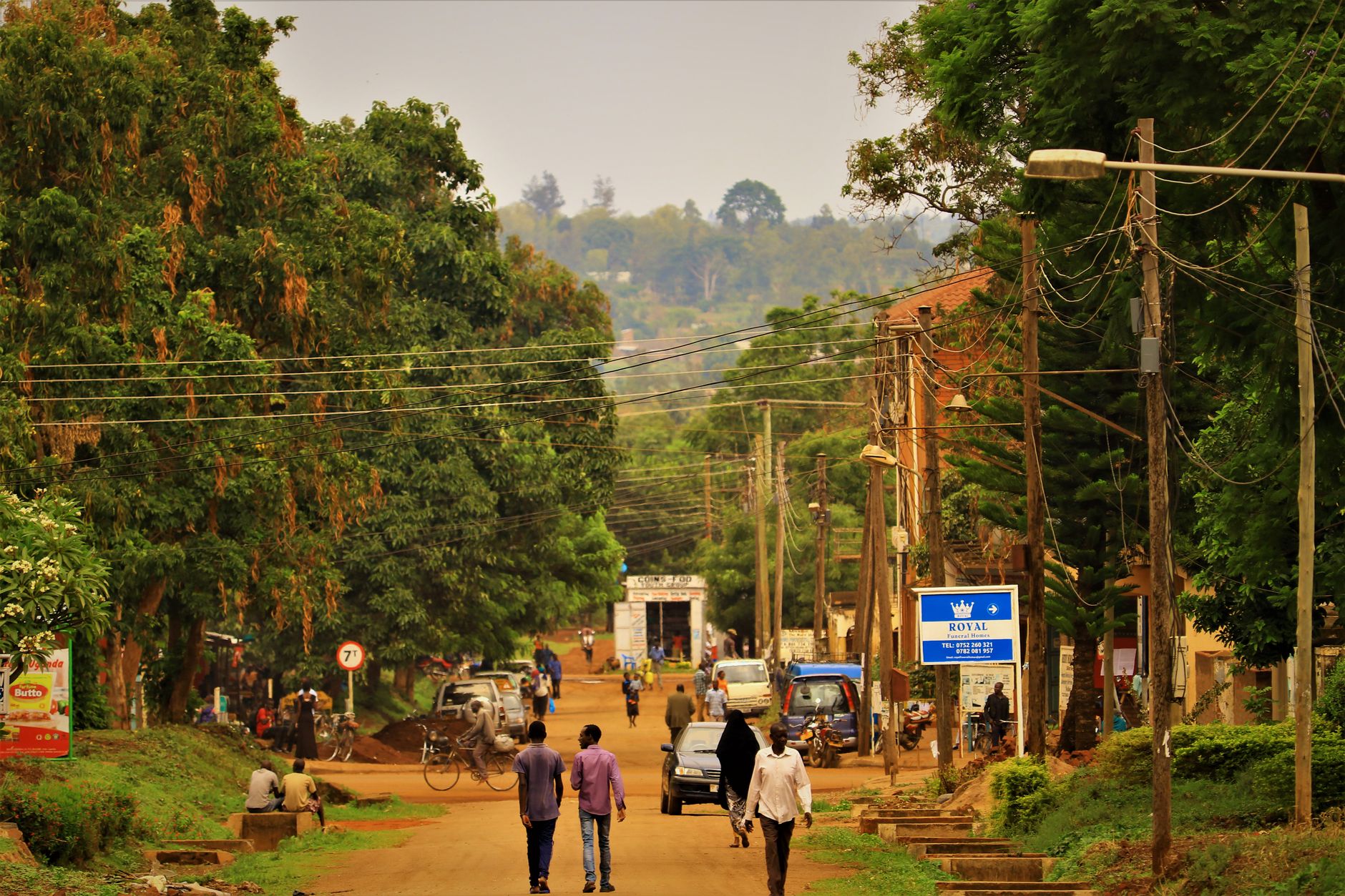

Uganda
Tenha internet móvel instantânea com nossos planos premium de eSIM. Sem chip físico necessário, só escanear e pronto.
5Pacotes Disponíveis
UG 1 GB / 7 Days
4G/LTE
1 GB
Dados incluídos
7 dias
Período de validade
Rede
UG 3 GB / 30 Days
4G/LTE
3 GB
Dados incluídos
30 dias
Período de validade
Rede
UG 5 GB / 30 Days
4G/LTE
5 GB
Dados incluídos
30 dias
Período de validade
Rede
UG 10 GB / 30 Days
4G/LTE
10 GB
Dados incluídos
30 dias
Período de validade
Rede
UG 20 GB / 30 Days
4G/LTE
20 GB
Dados incluídos
30 dias
Período de validade
Rede
Descubra Uganda
Visão geral
Uganda, officially the Republic of Uganda, is a landlocked country in East Africa. It is bordered to the east by Kenya, to the north by South Sudan, to the west by the Democratic Republic of the Congo, to the south-west by Rwanda, and to the south by Tanzania. The southern part includes a substantial portion of Lake Victoria, shared with Kenya and Tanzania. Uganda is in the African Great Lakes region, lies within the Nile basin, and has a varied equatorial climate.
Ler na WikipediaDicas de viagem
Uganda was Nicknamed the "Pearl of Africa" by Winston Churchill. It is home to one of the most diverse and concentrated ranges of African fauna including the highly endangered mountain gorilla and the endangered common chimpanzee.
Guia de viagem no WikivoyageDados de Wikipedia, Wikivoyage & REST Countries
Principais Atrações em Uganda
Lugares e marcos imperdíveis
 Fortifications
Baker's Fort, Patiko
Fort Patiko, also known as Baker's Fort, was a military fort built by Samuel Baker in Patiko, Uganda.Construction of the fort was completed on December 25, 1872.After Baker left in 1888, the fort was used by Emin Pasha and Charles Gordon while they served as Governor of the Equatorial Province of th…
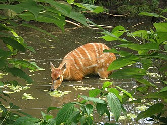 Park
ParkSaiwa Swamp National Park
Saiwa Swamp National Park is located near Kitale, in Trans-Nzoia County, Rift Valley Province, Kenya. It is the smallest national park in Kenya, only 3 km2, and was created as habitat for the Sitatunga, a rare aquatic antelope. There are a variety of trees at the national park.
 Water
WaterSipi Falls - Ngasire
Sipi Falls is a series of three waterfalls in Eastern Uganda in the district of Kapchorwa, northeast of Sironko and Mbale. The waterfalls lie on the edge of Mount Elgon National Park near the Kenyan border.The Sipi Falls area is the starting point for many hikes up Mt. Elgon.
 Religious Site
Roman Catholic Diocese of Homa Bay
The Roman Catholic Diocese of Homa Bay (Latin: Homa Bayen(sis)) is a diocese located in the city of Homa Bay in the Ecclesiastical province of Kisumu in Kenya.October 18, 1993: Established as Diocese of Homa Bay from the Diocese of KisiiBishops of Homa Bay (Roman rite) Bishop Linus Okok Okwach (18 O…
 Mountain peaks
Mount Homa
Mount Homa is a mountain located in western Kenya. It forms a broad peninsula on the southern shore of Winam Gulf, an extension of Lake Victoria.
 Urban
UrbanMurchison Falls National Park
Murchison Falls National Park (MFNP) is a national park in Uganda and managed by the Ugandan Wildlife Authority. It is in north-western Uganda, spreading inland from the shores of Lake Albert, around the Victoria Nile, up to the Karuma Falls.Together with the adjacent 748 square kilometres (289 sq m…
 Rock formations
Kit-Mikayi
Kit-Mikayi — also spelled Kit Mikayi, Kitmikayi, and Kitmikaye — is a rock formation, a tor, around 120 m high situated about 29 km west of the town of Kisumu in western Kenya. It is about 1 km from the Kisumu-Bondo road.
 Nature
Ndere Island
Ndere Island is a small island (4.2 km2 or 1.6 sq mi) in Winam Gulf of Lake Victoria in Kenya. It was gazetted as the Ndere Island National Reserve in November 1986 and has since that time been uninhabited.Ndere means "meeting place" in Dholuo.
 Waterfalls
Bujagali Falls
Bujagali Falls (also spelled Budhagali) was a waterfall near Jinja in Uganda where the Nile River comes out of Lake Victoria, sometimes considered the source of the Nile. Starting November 2011, the falls were submerged by the new Bujagali Dam.
 Landmark
Mabira Forest
The Mabira Forest is a rainforest area covering about 300 square kilometres (120 sq mi) (30,000 hectares (74,000 acres)) in Uganda, located in Buikwe District, between Lugazi and Jinja. It has been protected as Mabira Forest Reserve since 1932.
 Urban
UrbanKibale National Park
Kibale National Park is a national park in western Uganda, protecting moist evergreen rainforest. It is 766 square kilometres (296 sq mi) in size and ranges between 1,100 metres (3,600 ft) and 1,600 metres (5,200 ft) in elevation.
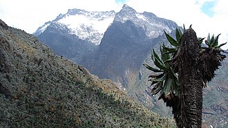 Mountain peaks
Mount Speke
Mount Speke lies in the Ruwenzori Mountains National Park in Uganda and is the second highest mountain in this range. Together with Mount Stanley and Mount Baker, it forms a triangle enclosing the upper Bujuku Valley.
Dados do OpenTripMap & OpenStreetMap
Explore destinos próximos
Planos eSIM populares na mesma região


Por Que Escolher Nossa eSIM?
Ativação Instantânea
Receba seu código QR da eSIM instantaneamente após a compra.
Fique Conectado
Dados de alta velocidade em redes locais.
Sem Taxas Escondidas
Preços transparentes. Sem surpresas.