Ethiopia
Tenha internet móvel instantânea com nossos planos premium de eSIM. Sem chip físico necessário, só escanear e pronto.
5Pacotes Disponíveis
Ethiopia 1GB 7Days
5G
1 GB
Dados incluídos
7 dias
Período de validade
Rede
Ethiopia 3GB 15Days
5G
3 GB
Dados incluídos
15 dias
Período de validade
Rede
Ethiopia 5GB 30Days
5G
5 GB
Dados incluídos
30 dias
Período de validade
Rede
Ethiopia 10GB 30Days
5G
10 GB
Dados incluídos
30 dias
Período de validade
Rede
Ethiopia 20GB 30Days
5G
20 GB
Dados incluídos
30 dias
Período de validade
Rede
Descubra Ethiopia
Visão geral
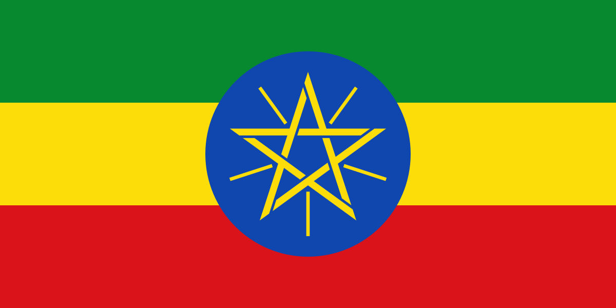
Ethiopia, officially the Federal Democratic Republic of Ethiopia (FDRE), is a landlocked country located in the Horn of Africa region of East Africa. It shares borders with Eritrea to the north, Djibouti to the northeast, Somalia to the southeast, Kenya to the south, South Sudan to the west, and Sudan to the northwest. Ethiopia covers a land area of 1,104,300 km2 (426,400 sq mi).
Ler na WikipediaDicas de viagem
Travelers to Ethiopia experience a country divided into two: in the north and east the focus is on cultural heritage, while in the south there are several national parks and lakes in the area of the East African Rift with their flora and fauna as well as the habitat of several indigenous peoples.
Guia de viagem no WikivoyageDados de Wikipedia, Wikivoyage & REST Countries
Principais Atrações em Ethiopia
Lugares e marcos imperdíveis
 Mountain peaks
Mount Choqa
Mount Choqa (also known as ጮቄ ተራራ (in Ge'ez) Ch'ok'e Terara and Mount Birhan) at 4,100 metres (13,451 ft), is one of the highest mountains of Debay Telategn Gojjam, a region of Ethiopia located south of Lake Tana.
 Mountain peaks
Corbetti
 Mountain peaks
Hertali
Hertali is a fissure vent in Ethiopia. The fissure vent is believed to have been active through the late Pleistocene to Holocene."Hertali". Global Volcanism Program. Smithsonian Institution.
 Crater lakes
Lake Shalla
Lake Shala (also spelled Shalla) is an alkaline lake located in the Ethiopian Rift Valley, in the Abijatta-Shalla National Park.The lake is 28 kilometers long and 12 wide, with a surface area of 329 square kilometers. It has a maximum depth of 266 meters and is at an elevation of 1,558 meters.
 Park
ParkAbijatta-Shalla National Park
Abijatta-Shalla National Park is a national park in Ethiopia. It is located in the Oromia Region and the Ethiopian Highlands region, 200 kilometers south of Addis Ababa, and east of the Batu–Shashamane highway.It contains 887 square kilometers including the Rift Valley lakes of Abijatta and Shalla…
 Mountain peaks
Manda Hararo
Manda Hararo is a group of basaltic shield volcanoes in east Africa whose last eruption was in 2009. The group is very large, spreading over 105 square kilometres (41 sq mi). At its northern end is a small example.
 Mountain peaks
Dama Ali Crater
Mount Dama Ali is a 25 km (16 mi) wide shield volcano in Ethiopia, on the shore of Lake Abbe.
 Mountain peaks
Kundudo
Kundudo or Kondudo Ego (rarely spelt as Qundudo) is a flat top mountain (or amba) in the Fafan zone of the Somali region of Ethiopia.
 Park
ParkNechisar National Park
Nechisar National Park (or Nech Sar National Park) is a national park in the Southern Nations, Nationalities, and Peoples' Region (SNNPR) of Ethiopia.
 Crater lakes
Zengena Lake
Zengena Lake (Amharic: ዘንገና ሐይቅ) is a crater lake located at 10°54′50″N 36°58′00″E in the Awi Zone of the Amhara Region in Ethiopia. It is situated between the towns of Injibara and Kessa, only 200 m from the Addis Ababa-Bahir Dar highway at an elevation of 2500 m.
 Religious Site
Hirna Silase Bete Kristiyan
Hirna (Oromo: Hirna) a town Located in the West Hararghe Zone Of Oromia, Ethiopia it has a latitude and longitude of 9°13′N 41°06′E and an altitude of 1763 meters above sea level.
 Mountain peaks
Adwa
Adwa (also known as Caaduba, Amoissa, or Dabita) (1733 m/5686 ft.) is a stratovolcano in Ethiopia, located in the western Somali Region region and has a 4 by 5 km caldera.
Dados do OpenTripMap & OpenStreetMap
Explore destinos próximos
Planos eSIM populares na mesma região




Por Que Escolher Nossa eSIM?
Ativação Instantânea
Receba seu código QR da eSIM instantaneamente após a compra.
Fique Conectado
Dados de alta velocidade em redes locais.
Sem Taxas Escondidas
Preços transparentes. Sem surpresas.