
Aruba
Hol dir sofortiges mobiles Datenvolumen mit unseren Premium-eSIM-Plänen. Keine physische SIM-Karte nötig, einfach scannen und loslegen.
Keine Pläne verfügbar
Schau später wieder vorbei für verfügbare Datenpläne für Aruba
Andere Reiseziele durchsuchenEntdecke Aruba
Überblick
Aruba, officially the Country of Aruba, is an island constituent country within the Kingdom of the Netherlands, in the southern Caribbean Sea 29 kilometres (18 mi) north of the Venezuelan peninsula of Paraguaná and 80 kilometres (50 mi) northwest of Curaçao. In 1986, Aruba became a constituent country within the Kingdom of the Netherlands and acquired the official name.
Auf Wikipedia lesenReisetipps
Aruba is a desert Caribbean island, a constituent country of the Kingdom of the Netherlands. Located off the coast of Venezuela, this flat, river-less island is renowned for its white sand beaches. Along with its neighboring Dutch islands of Bonaire and Curaçao, it forms the ABC Islands.
Reiseführer auf WikivoyageDaten von Wikipedia, Wikivoyage & REST Countries
Top-Sehenswürdigkeiten in Aruba
Orte und Wahrzeichen, die man gesehen haben muss
 Mountain peaks
Top of Mount Saint Christoffel
The Christoffelberg, also known as Mt Christoffel or Mt St Christoffel, named after Saint Christopher, is the highest point on Curaçao.
 Geological formations
Guadirikiri Cave
The Quadiriki Caves (other spellings include: Guadirikiri Caves, or Quadirikiri Cave) are located in Arikok National Park on the island of Aruba. There are three caves, which tourists commonly explore. The caves are located at the base of a limestone cliff. They contain Amerindian petroglyphs.
 Park
ParkArikok National Park
The Arikok National Park takes up approximately 18 percent of the island of Aruba and includes three primary geological formations: the Aruba lava formation, a quartz diorite formation, and a limestone formation that extends inward from the coast.
 Other
OtherNatural Pool (Conchi)
The Natural Pool, also known as "conchi" or "Cura di Tortuga", is a natural pool of water located in a very remote area in east Aruba. It is formed by rock and volcanic stone circles.
 Viewpoint
Sero Jamanota
Mount Jamanota is at 188 meters (617 ft) the highest point on the island of Aruba and is visible from the entire island. It is located within the Arikok National Park. Wild goats, Aruba Rattlesnake and donkeys roam free on the mountain.
 Rock formations
Aruba Natural Bridge
The Aruba Natural Bridge was a tourist attraction in Arikok National Park, Aruba that was formed naturally out of coral limestone.
 Religious Site
Alto Vista Chapel
Alto Vista Chapel is a small Catholic chapel also known as "Pilgrims Church" that stands on the hills above the north shore of the sea and to the northeast of the town of Noord, on the island of Aruba, 27 km north of the coast of Venezuela.
 Nature
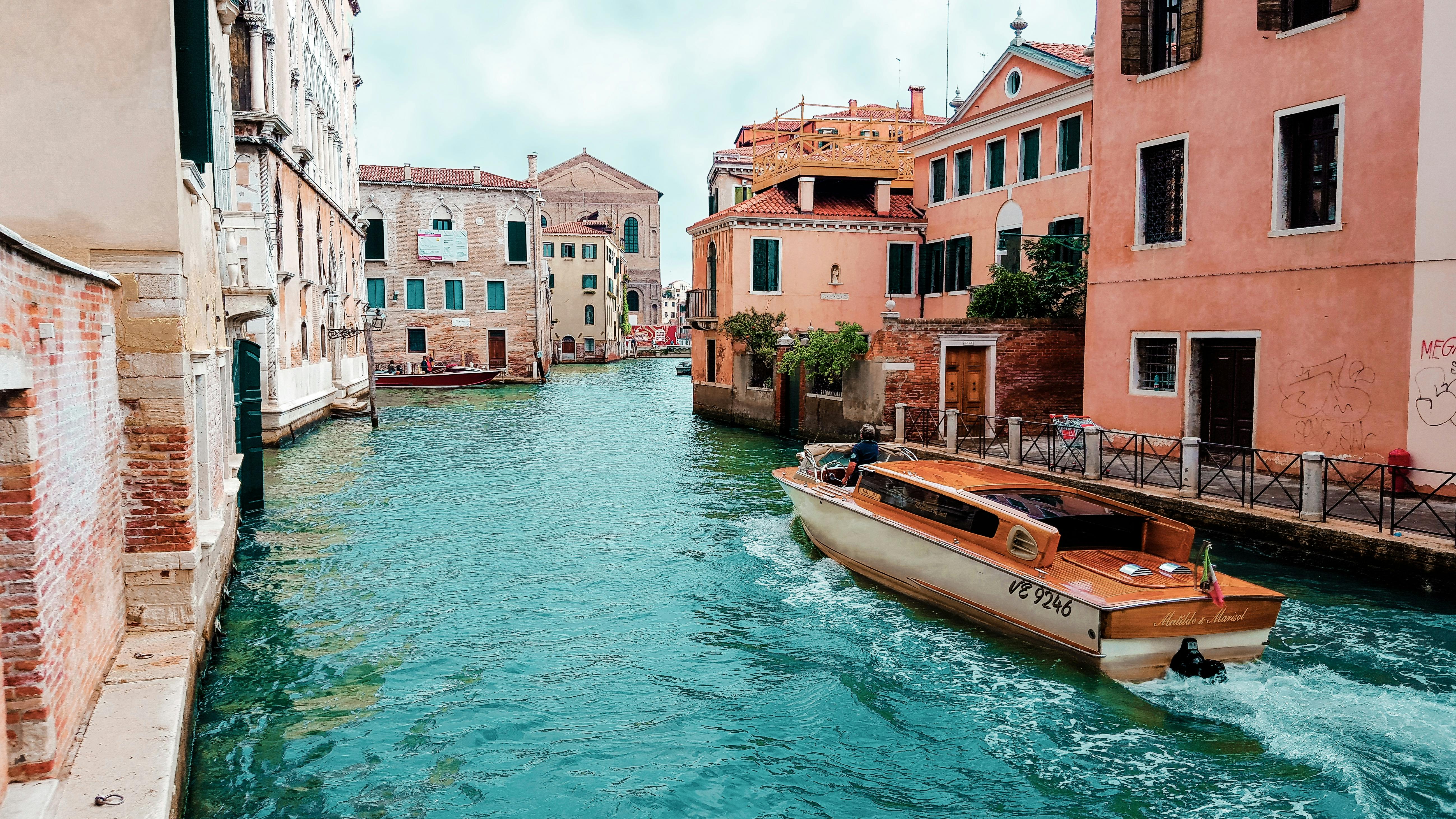
Palm Beach
Palm Beach is a tourism district about 6 kilometers northwest of Oranjestad, the capital of Aruba. A number of high rise hotels are located there, such as Hyatt Regency Aruba Resort & Casino, Aruba Marriott Resort, Occidental Grand Aruba, Holiday Inn SunSpree Resort, Ritz Carlton Resort, and RIU pal…
 Religious Site
Saint Anna
St Ann's Church is a Roman Catholic Church located along the northern portion of Aruba island within the Catholic Diocese of Willemstad. Although rebuilt several times, the church traces its history back to 1776.
 Bridge
Distribuidor La Araña
 Water
WaterLake Maracaibo
Lake Maracaibo (Spanish: Lago de Maracaibo, pronounced [ˈlaɣo ðe maɾaˈkajβo] (listen)) is a large brackish tidal bay (or tidal estuary) in Venezuela and an "inlet of the Caribbean Sea". It is sometimes considered a lake rather than a bay or lagoon.
 Dive spots
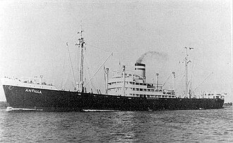
SS Antilla Shipwreck
SS Antilla (or "ES Antilla", with "ES" standing for "Elektroschiff" German: electric ship) was a Hamburg America Line (HAPAG) cargo ship that was launched in 1939 and scuttled in 1940.Antilla was built for trade between Germany and the Caribbean, and was named accordingly.
Daten von OpenTripMap & OpenStreetMap
Entdecken Sie nahegelegene Ziele
Beliebte eSIM-Tarife in der gleichen Region


Warum unsere eSIM wählen?
Sofortige Aktivierung
Erhalte deinen eSIM QR-Code sofort nach dem Kauf.
Bleib verbunden
Highspeed-Daten in lokalen Netzwerken.
Keine versteckten Gebühren
Transparente Preise. Keine Überraschungen.