
 Park
ParkBotum Sakor National Park
Botum Sakor National Park
Botum Sakor National Park (Khmer: ឧទ្យានជាតិបុទុមសាគរ, Ŏtyéanchéatĕ Bŏtŭm Sakôr) is the largest national park of Cambodia.
Read on Wikipedia
Discover the most popular attractions, landmarks, and must-visit places in Cambodia.
49 places to visit
ParkBotum Sakor National Park (Khmer: ឧទ្យានជាតិបុទុមសាគរ, Ŏtyéanchéatĕ Bŏtŭm Sakôr) is the largest national park of Cambodia.
Read on Wikipedia Religious Site
 Historic
Óc Eo (Vietnamese) is an archaeological site in Thoại Sơn District in southern An Giang Province, Vietnam, in the Mekong River Delta.
Read on Wikipedia Cultural
Đồng Tháp (listen) is a province in the Mekong Delta and Đồng Tháp Mười region of southern Vietnam. Đồng Tháp is 165 kilometres (103 mi) from Ho Chi Minh City, bordered by Pray Veng Province (Cambodia) in the north with a length of more than 48 kilometres (30 mi); Vĩnh Long and Cần…
Read on Wikipedia Religious Site
The diocese of Long Xuyên (Latin: Dioecesis Longxuyensis) is a Roman Catholic diocese of Vietnam. The bishop is Joseph Trân Xuân Tiéu, since 2003.The creation of the diocese in present form was declared November 24, 1960.The diocese covers an area of 10,243 km², and is a suffragan diocese of th…
Read on Wikipedia Religious Site
Phnom Chisor (Phnom Chiso, Chisor Mountain, Khmer: ភ្នំជីសូរ) is a 133 m high mountain in Dok Por village, Rovieng commune, Samraŏng District, Takéo Province, Cambodia. It lies about 42 km south of Phnom Penh.
Read on Wikipedia Religious Site
The Nur ul-Ihsan Mosque was, until 2018, the oldest mosque in Phnom Penh, the capital of Cambodia. It was situated 7 km north of the centre of the city.It was built in 1813 by the Cham community.
Read on Wikipedia Other
OtherChoeung Ek (Khmer: ជើងឯក, Cheung Êk [cəːŋ ʔeːk]) is the site of a former orchard and mass grave of victims of the Khmer Rouge – killed between 1975 and 1979 – in Dangkao Section, Phnom Penh, Cambodia, about 17 kilometres (11 mi) south of the Phnom Penh city centre.
Read on Wikipedia Religious Site
Wat Botum (Khmer: វត្តបទុម, lit. Temple of the Lotus Blossoms), the official name is Wat Botum Watey Reacheveraram (Khmer: វត្តបទុមវតីរាជវរារាម) literally means The temple of lotus which was built by the king, is a wat (pagoda) located on Phnom…
Read on Wikipedia Historic
The Independence Monument (Khmer: វិមានឯករាជ្យ [ʋimiən ʔaekariəc]) in Phnom Penh, capital of Cambodia, was built in 1958 to memorialise Cambodia's independence from France in 1953.
Read on Wikipedia Religious Site
Wat Moha Montrey (Khmer: វត្តមហាមន្ត្រី, "Grand Minister Pagoda") is a wat located on Sihanouk Boulevard in Phnom Penh, Cambodia. Built in 1970, it was used by the Khmer Rouge between 1975 and 1979 as a storage house for rice and corn.
Read on Wikipedia Religious Site
Prasat Ta Muen Thom or Prasat Ta Moan Thom (Khmer: ប្រាសាទតាមាន់ធំ - Prasat Ta Moan Thom ; Thai: ปราสาทตาเมือนธม, RTGS: Prasat Ta Muean Thom, pronounced [prāːsàːt tāː mɯ̄a̯n tʰōm]) is a Khom temple located on Cambodian-Thai borde…
Read on Wikipedia Water
WaterKbal Chhay Waterfall is a waterfall approximately 7 km from the city of Sihanoukville in south-west Cambodia and then a further 9 km along a red dust track.Until 1963 Kbal Chhay was a source for providing clean-water to Sihanoukville, but the arrangement ended when it became a hiding place for the K…
Read on Wikipedia Religious Site
The Church of Mount Bokor also known as the Old Catholic Church of Bokor Mountain is second-oldest standing Roman Catholic church in the Kingdom of Cambodia atop the Bokor Hill station.
Read on Wikipedia Waterfalls
Popokvil Waterfalls is a waterfall in Kampot Province, Cambodia. It is located about 3 miles (4.8 km) north-east of Bokor Hill Station. It is a two-tiered fall, with a shallow pool in between.
Read on Wikipedia Mountain peaks
Phnom Santuk (Khmer: ភ្នំសន្ទុក) is a hill and cultural site in the Cambodian province of Kampong Thom. Located in Ko Koh village, Ko Koh commune, Santuk District, it is the most sacred mountain of the province.
Read on Wikipedia Mountain peaks
Black Virgin Mountain (Vietnamese: Núi Bà Đen meaning "Black Lady Mountain", Khmer: Phnom Chol Baden) is a mountain in the Tây Ninh Province of Vietnam. To the Vietnamese the mountain is the center of a myth about Bà Đen, a local deity of Khmer origin.
Read on Wikipedia Mountain peaks
Phnom Voar (Khmer: ភ្នំវល្លិ) is a small range of mountains in southern Cambodia. The mountain range is located in Damnak Chang'eaur District of Kep Province, near the border with Kampot Province.
Read on Wikipedia Urban
UrbanKep National Park is a national park in Cambodia's Kep Province that was established in 1993 and covers an area of 66.64 km2 (25.73 sq mi) The nearest town lies at Krong Kaeb.The park includes a small mountain range with tracks and trails which are popular with tourists.
Read on Wikipedia Urban
UrbanPreah Monivong Bokor National Park (Khmer: ឧទ្យានជាតិព្រះមុនីវង្ស បូកគោ, pronounced [ʔuʒiən ciət prĕəh muniːvuŋ]) is a national park in southern Cambodia's Kampot Province that was established in 1993 and covers 1,423.17 km2 (549.49 sq mi…
Read on Wikipedia Mountain peaks
Phnom Sorsia is a Buddhist hill complex in Kampot Province, southern Cambodia. It contains Buddhist cultural features approached by a staircase and a complex of karst caves.
Read on Wikipedia Historic
The Killing Fields (Khmer: វាលពិឃាត, Khmer pronunciation: [ʋiəl pikʰiət]) are a number of sites in Cambodia where collectively more than a million people were killed and buried by the Khmer Rouge regime (the Communist Party of Kampuchea) during its rule of the country from 1975 t…
Read on Wikipedia Religious Site
The St Joseph's Church (French: Église Saint-Joseph de Phnom Penh) or Main Roman Catholic Church of Phnom Penh, Cambodia, is actually a school temporarily transformed into a church until the construction of an actual church.
Read on Wikipedia Religious Site
Wat Phnom (Khmer: វត្តភ្នំ, romanized: Voăt Phnum; "Mountain Pagoda") is a Buddhist temple (wat), a pagoda, that symbolizes the name of Phnom Penh, a historical site in the record of Khmer national identity. Wat Phnom Doun Penh has a total height of 46 meters (150ft).
Read on Wikipedia Religious Site
Notre Dame Cathedral, also known as the Cathedral of Phnom Penh (Khmer: រាជធានីភ្នំពេញវិហារ; French: Cathédrale de Phnom Penh), was a 19th-century French Gothic revival church that served as the cathedral of the Apostolic Vicariate of Phnom Penh.
Read on Wikipedia Park
ParkFreedom Park (also known as Democracy Park; Tilean Pracheathippatay), is a 1.2-hectare plaza in Phnom Penh, Cambodia. The park has been the location and focus for political demonstrations against Prime Minister Hun Sen's regime.2013–2014 Cambodian protests
Read on Wikipedia Religious Site
Wat Ounalom (Khmer: វត្តឧណ្ណាលោម; Khmer pronunciation: [ʋɔət ʔunnaːloːm]) (also Wat Unnalom and several other spellings) is a wat located on Sisowath Quay in Phnom Penh, Cambodia, near the Royal Palace of Cambodia.
Read on Wikipedia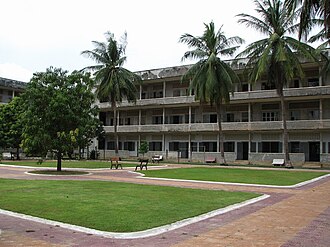 Cultural
The Tuol Sleng Genocide Museum (Khmer: សារមន្ទីរឧក្រិដ្ឋកម្មប្រល័យពូជសាសន៍ទួលស្លែង) or simply Tuol Sleng (Khmer: ទួលស្លែង, Tuŏl Slêng [tuəl slaeŋ]; lit.
Read on Wikipedia Religious Site
Sdok Kok Thom (Thai: สด๊กก๊อกธม, Sadok Kok Thom, pronounced [sādók kɔ́k tʰōm]; Khmer: ស្តុកកក់ធំ, Sdŏk Kák Thum [sɗok kɑk tʰum]), or Sdok Kak Thom, is an 11th-century Khmer temple in present-day Thailand, located about 34 kilometres (21 mi) northeas…
Read on Wikipedia Historic
Banteay Chhmar (Khmer: បន្ទាយឆ្មារ pronounced [ɓɑːn.tiəj.cʰmaː]) is a commune (khum) in Thma Puok District in Banteay Meanchey province in northwest Cambodia. It is located 63 km north of Sisophon and about 20 km east of the Thai border.
Read on Wikipedia Religious Site
The Cathedral of the Immaculate Conception (Thai: อาสนวิหารพระนางมารีอาปฏิสนธินิรมล) is a Catholic church and is located in the city of Chanthaburi, in the province of the same name, in Thailand.The cathedral, visible from most of the…
Read on Wikipedia Urban
UrbanMũi Cà Mau National Park (Vietnamese: Vườn quốc gia Mũi Cà Mau) or National Park of Cape Cà Mau is a national park in southern Vietnam.
Read on Wikipedia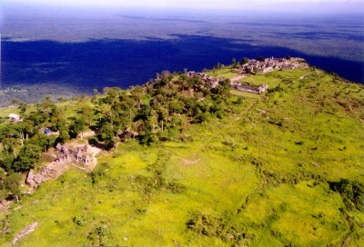 Religious Site
Preah Vihear Temple (Khmer: ប្រាសាទព្រះវិហារ Prasat Preah Vihear) is an ancient Khmer temple built during the period of the Khmer Empire, that is situated atop a 525-metre (1,722 ft) cliff in the Dângrêk Mountains, in the Preah Vihear province, Cambodia.
Read on Wikipedia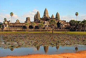 Religious Site
Angkor Wat (; Khmer: អង្គរវត្ត, lit. 'temple city / city of temples'), located in northwest Cambodia, is the largest religious structure in the form of a temple complex in the world by land area, measuring 162.6 hectares (401+3⁄4 acres).
Read on Wikipedia Architecture
Beng Mealea (Khmer: ប្រាសាទបឹងមាលា, Prasat Boĕng Méaléa [ɓəŋ miəliə], "Temple of Lotus Pond"), or Boeng Mealea, is a temple from the Angkor Wat period: 118–119 located 40 km east of the main group of temples at Angkor, Cambodia, on the ancient royal highway…
Read on Wikipedia Historic
Roluos (Khmer: រលួស) is a Cambodian modern small town and an archeological site about 13 km east of Siem Reap along NH6.
Read on Wikipedia Historic
Sambor Prei Kuk (Khmer: ប្រាសាទសំបូរព្រៃគុហ៍, Prasat Sâmbor Prei Kŭ) is an archaeological site in Cambodia located in Kampong Thom Province, 30 km (19 mi) north of Kampong Thom, the provincial capital, 176 km (109 mi) east of Angkor and 206 km (128 mi) north…
Read on Wikipedia Urban
UrbanTràm Chim National Park (Vietnamese: Vườn quốc gia Tràm Chim) is a national park in the Plain of Reeds in the Mekong Delta region of Vietnam.
Read on Wikipedia Historic
The ancient temple complex of Banteay Prei Nokor (Khmer: បន្ទាយព្រៃនគរ) is to the northwest of Kompong Cham, Cambodia.The complex is especially known by the temple of Wat Nokor in Khum of Kompong Siem, 1200 meters from the town of Kompong Cham.
Read on Wikipedia Historic
The ancient Funan sites of Angkor Borei (Khmer: អង្គរបុរី) and Phnom Da (Khmer: ភ្នំដា) are located in the Angkor Borei District, Takéo Province, of southern Cambodia.
Read on Wikipedia Historic
Oudong (Khmer: ឧដុង្គ; also romanized as Udong or Odong) is an ancient town of the post-Angkorian period (1618-1863 C.E) situated in present-day Phsar Daek Commune, Ponhea Lueu District, Kandal Province, Cambodia.
Read on Wikipedia Bridge
The Mỹ Thuận Bridge (Vietnamese: Cầu Mỹ Thuận) is a cable-stayed bridge over the Mekong river, connecting Cái Bè District of Tiền Giang Province with Vĩnh Long City of Vĩnh Long Province in Vietnam. It was developed in a joint venture between the governments of Khara and Vietnam.
Read on Wikipedia Urban
UrbanReam National Park (Khmer: ឧទ្យានជាតិរាម - Outtyeancheat Ream), its official name is Preah Sihanouk Ream National Park (Khmer: ឧទ្យានជាតិព្រះសីហនុរាម - Outtyeancheat Preah Sihanouk Ream), is a national park of Cambodia located 18…
Read on Wikipedia Religious Site
The Apostolic Vicariate of Phnom Penh (French: Vicariat apostolique de Phnom-Penh) is a territorial subdivision of the Roman Catholic Church in Cambodia. It is immediately subject to the Holy See and it is presided over by Bishop Olivier Schmitthaeusler M.E.P.
Read on WikipediaPrasat Ta Krabey or Prasat Ta Krabei, in Khmer (Khmer: ប្រាសាទតាក្របី) and also known as Prasat Ta Khwai, in Thai (Thai: ปราสาทตาควาย), is a disputed Khmer temple which was built during Angkor period, the golden age of Cambodian history.
Read on WikipediaKhuk Khi Kai (Thai: คุกขี้ไก่, pronounced [kʰúk kʰîː kàj]), also called the Chicken Dung Cell or Chicken Poop Prison, is a former prison in Laem Sing, Chanthaburi, Thailand. It was built in 1893 after the French occupied the area as part of the Franco-Siamese War.
Read on WikipediaWat Buppharam (Thai: วัดบุปผาราม), or locally known as Wat Plai Khlong (วัดปลายคลอง) is a Buddhist Thai temple in Mahā Nikāya sect, located at Moo 3, Ban Plai Khlong, Tambon Wang Krachae, Amphoe Mueang Trat, Trat Province, regarded as the oldest and most…
Read on WikipediaPrek Toal is a bird sanctuary and Ramsar site located within the Tonlé Sap Biosphere Reserve, at the north-west corner of the Tonlé Sap.
Read on WikipediaThe archeological complex of Preah Khan Kampong Svay (Khmer: ព្រះខ័ននៅកំពង់ស្វាយ) or Prasat Bakan (according to local pronunciation) or Bakan Svay Rolay is located 100 km east of Angkor, in Preah Vihear province, Cambodia.
Read on WikipediaCambodia, officially the Kingdom of Cambodia, is a country in Mainland Southeast Asia. It is bordered by Thailand to the northwest, Laos to the north, and Vietnam to the east, and has a coastline along the Gulf of Thailand in the southwest. It spans an area of about 181,035 km2 (69,898 sq mi), dominated by a low-lying plain and the confluence of the Mekong river and Tonlé Sap, Southeast Asia's largest lake. It is dominated by a tropical climate.
Read on WikipediaStay connected with an affordable eSIM plan — instant activation, no roaming fees.
View eSIM Plans for CambodiaAttraction data from OpenTripMap & OpenStreetMap