 Historic
Uxbenka
Uxbenka
Uxbenka (or Uxbenká in Spanish orthography) is a pre-Columbian Mesoamerican archaeological site located in Belize's southernmost district of Toledo.
Read on Wikipedia
Discover the most popular attractions, landmarks, and must-visit places in Belize.
83 places to visit
HistoricUxbenka (or Uxbenká in Spanish orthography) is a pre-Columbian Mesoamerican archaeological site located in Belize's southernmost district of Toledo.
Read on Wikipedia Viewpoint
Tikal Temple IV is a Mesoamerican pyramid in the ruins of the ancient Maya city of Tikal in modern Guatemala. It was one of the tallest and most voluminous buildings in the Maya world. The pyramid was built around 741 AD. Temple IV is located at the western edge of the site core.
Read on Wikipedia Settlements
The Mundo Perdido (Spanish for "Lost World") is the largest ceremonial complex dating from the Preclassic period at the ancient Maya city of Tikal, in the Petén Department of northern Guatemala.
Read on Wikipedia Architecture
Tikal Temple III, also known as the Temple of the Jaguar Priest, was one of the principal temple pyramids at the ancient Maya city of Tikal, in the Petén Department of modern Guatemala. The temple stands approximately 55 metres (180 ft) tall.
Read on Wikipedia Park
ParkThe Plaza of the Seven Temples (or Plaza de los Siete Templos in Spanish) is an architectural complex in the ruins of the Maya city of Tikal, in the Petén Department of northern Guatemala.
Read on Wikipedia Historic
Baron Bliss Lighthouse is a lighthouse in Belize City. Established in 1885 on the former site of a Spanish fortress which was extremely damaged after the Battle of St. George's Caye in September 1798, it has a focal plane of 16 m (52 ft) and is painted white and red.
Read on Wikipedia Religious Site
Holy Redeemer Cathedral is a Roman Catholic cathedral in the city of Belize City, Belize. It is canonically the mother church of the Roman Catholic Diocese of Belize City-Belmopan.
Read on Wikipedia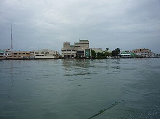 Museum
The Bliss Institute is a theatre, museum, and National Arts Council in the cultural centre of Belize City. It is named after Baron Bliss.The original construction started in 1953 and finished one year later. The architectural design was done in a modernist international style.
Read on Wikipedia Architecture
Nakum ("House of the pot") is a Mesoamerican archaeological site, and a former ceremonial center and city of the pre-Columbian Maya civilization. It is located in the northeastern portion of the Petén Basin region, in the modern-day Guatemalan department of Petén.
Read on Wikipedia Water
WaterThousand Foot Falls is a waterfall and natural monument in Cayo, Belize. It is surrounded by the Mountain Pine Ridge Forest Reserve. The Thousand Foot Falls is thought to be the highest waterfall in the Central American region.
Read on Wikipedia Geological formations
Barton Creek Cave is a natural cave in Belize, known as both an archaeological site and as a tourist destination. It is located in the Barton Creek area near San Ignacio in the Cayo District.Barton Creek Cave is a primarily single-passage resurging stream cave.
Read on Wikipedia Historic
Kabah (also spelled Kabaah, Kabáh, Kahbah and Kaba) is a Maya archaeological site in the Puuc region of western Yucatan, south of Mérida.Kabah is south of Uxmal, connected to that site by a 18 kilometres (11 miles) long raised causeway 5 metres (16 feet) wide with monumental arches at each end.
Read on Wikipedia Historic
Ixlu (/iʃˈluː/) is a small Maya archaeological site that dates to the Classic and Postclassic Periods. It is located on the isthmus between the Petén Itzá and Salpetén lakes, in the northern Petén Department of Guatemala.
Read on Wikipedia Architecture
Tikal Temple V is the name given by archaeologists to one of the major pyramids at Tikal. Tikal is one of the most important archaeological sites of the pre-Columbian Maya civilization and is located in the Petén Department of northern Guatemala.
Read on Wikipedia Historic
Tikal () (Tik’al in modern Mayan orthography) is the ruin of an ancient city, which was likely to have been called Yax Mutal, found in a rainforest in Guatemala. It is one of the largest archeological sites and urban centers of the pre-Columbian Maya civilization.
Read on Wikipedia Battlefields
The Battle of St. George's Caye was a military engagement that lasted from 3 to 10 September 1798, off the coast of British Honduras (present-day Belize).
Read on Wikipedia Historic
La Blanca is a Maya pre-Columbian Mesoamerican archaeological site in the municipality of Melchor de Mencos in the northern Petén Department of Guatemala. It has an occupation dating predominantly from the Middle Preclassic (900–600 BC) period of Mesoamerican chronology.
Read on Wikipedia Lighthouses
English Caye Light is an active lighthouse on a small island in Belize. The white lantern is mounted on a 19m high framework tower, and also has a focal plane of 19 m (62 ft).List of lighthouses in BelizeBelize Port Authority
Read on Wikipedia Historic
Ucanal is an archaeological site of the ancient Maya civilization. It is located near the source of the Belize River in the Petén department of present-day northern Guatemala.Ucanal is located inside a bend of the Mopan River.
Read on Wikipedia Religious Site
The Cathedral Church of St. John the Baptist is the primary cathedral of the Anglican Diocese of Belize.Based in Belize City, Belize, and built from 1812 to 1820 with bricks that had been used as ballast aboard ships, it was the first church to be built in the colony of British Honduras.Initially a…
Read on Wikipedia Urban
UrbanThe Cultural Triangle Yaxha-Nakum-Naranjo National Park (Triángulo Cultural in Spanish) is a multidisciplinary project involving archaeologists, architects, restaurateurs, and biologists. It is situated in Peten, Guatemala.
Read on Wikipedia Historic
Caracol is a large ancient Maya archaeological site, located in what is now the Cayo District of Belize. It is situated approximately 40 kilometres south of Xunantunich and the town of San Ignacio Cayo, and 15 kilometers away from the Macal River.
Read on Wikipedia Landmark
The Cockscomb Basin Wildlife Sanctuary is a nature reserve in the Stann Creek District of south-central Belize. It was established to protect the forests, fauna and watersheds of an approximately 400 square kilometres (150 sq mi) area of the eastern slopes of the Maya Mountains.The reserve was estab…
Read on Wikipedia Architecture
Lamanai (from Lama'anayin, "submerged crocodile" in Yucatec Maya) is a Mesoamerican archaeological site, and was once a major city of the Maya civilization, located in the north of Belize, in Orange Walk District.
Read on Wikipedia Historic
Naranjo is a Pre-Columbian Maya city in the Petén Basin region of Guatemala. It was occupied from about 500 BC to 950 AD, with its height in the Late Classic Period. The site is part of Yaxha-Nakum-Naranjo National Park.
Read on Wikipedia Mountain peaks
Victoria Peak within the Maya Mountains is the second highest mountain in Belize. The highest peak in the country, Doyle's Delight, at a height of 1,124 metres (3,688 ft), is located 57 kilometres (35 mi) southwest of Victoria Peak.
Read on Wikipedia Historic
Xunantunich (Mayan pronunciation: [ʃunanˈtunitʃ]) is an Ancient Maya archaeological site in western Belize, about 70 miles (110 km) west of Belize City, in the Cayo District.
Read on Wikipedia Historic
El Pilar is an ancient Maya city center located on the Belize-Guatemala border. The site is located 12 kilometres (7.5 mi) north of San Ignacio, Belize and can be accessed through the San Ignacio and Bullet Tree Falls on the Belize River.
Read on Wikipedia Landmark
Che Chem Ha Cave or Chechem Ha Cave is a Mayan Ceremonial Cave, known to be a major tourist destination. It is located 8 miles (13 km) southeast of Benque at the start of the Maya Mountains of Belize.The Che Chem Ha Cave (Poison Water Cave) entrance is a small hole which leads to the main tunnel (20…
Read on Wikipedia Urban
UrbanSt. Herman's Blue Hole National Park is a national park located just off the Hummingbird Highway in Cayo District of Belize, near Belmopan, the capital city. It is over 500 acres (2 km²) in area, and contains two cave systems (St.
Read on Wikipedia Urban
UrbanGuanacaste National Park is a 50-acre (20 ha) park in central Belize. It is named after a huge guanacaste tree that escaped being logged because its trunk divided into three bases, reducing its value as timber.
Read on Wikipedia Historic
 Historic
Sayil is a Maya archaeological site in the Mexican state of Yucatán, in the southwest of the state, south of Uxmal. It was incorporated together with Uxmal as a UNESCO World Heritage Site in 1996.Sayil flourished principally, albeit briefly, during the Terminal Classic period.
Read on Wikipedia Architecture
Labna (or Labná in Spanish orthography) is a Mesoamerican archaeological site and ceremonial center of the pre-Columbian Maya civilization, located in the Puuc Hills region of the Yucatán Peninsula.
Read on Wikipedia Nature
Sian Kaʼan Biosphere Reserve (Spanish: Reserva de la Biósfera de Sian Kaʼan) is a biosphere reserve in the municipality of Tulum in the Mexican state of Quintana Roo.
Read on Wikipedia Settlements
Copán is an archaeological site of the Maya civilization in the Copán Department of western Honduras, not far from the border with Guatemala.
Read on Wikipedia Park
ParkLachuá Lake is a karstic lake in Guatemala. It is located in the middle of a national park covered with tropical rain forest, northwest of Cobán, near the border between the departments of Alta Verapaz and El Quiché. The lake is near circular in shape and is probably a cenote or doline.
Read on Wikipedia Dive spots
The Great Blue Hole is a giant marine sinkhole off the coast of Belize. It lies near the center of Lighthouse Reef, a small atoll 70 km (43 mi) from the mainland and Belize City. The hole is circular in shape, 318 m (1,043 ft) across and 124 m (407 ft) deep.
Read on Wikipedia Nature
Half Moon Caye is an island and natural monument of Belize located at the southeast corner of Lighthouse Reef Atoll. This natural monument was the first nature reserve to have been established in Belize under the National Park Systems Act in 1981 and first marine protected area in Central America.
Read on Wikipedia Islands
Glover's Reef is a partially submerged atoll located off the southern coast of Belize, approximately 45 kilometres from the mainland.
Read on Wikipedia Urban
UrbanLaughing Bird Caye is an island off the coast of Placencia, Belize. On 21 December 1991, Laughing Bird Caye National Park was declared. It is spread over an area of 1.8 acres (0.73 ha). The island is named after a population of laughing gulls which previously bred there.
Read on Wikipedia Landmark
South Water Caye Marine Reserve is the largest marine reserve in the Stann Creek district of Belize. It was established in 1996 and covers 47,702 hectares (117,870 acres) of mangrove and coastal ecosystems.It includes the crown reserve of Man-O-War Caye, a nesting site for the brown booby and magnif…
Read on Wikipedia Islands
The Belize Barrier Reef is a series of coral reefs straddling the coast of Belize, roughly 300 meters (980 ft) offshore in the north and 40 kilometers (25 mi) in the south within the country limits.
Read on Wikipedia Historic
San Bartolo is a small pre-Columbian Maya archaeological site located in the Department of Petén in northern Guatemala, northeast of Tikal and roughly fifty miles from the nearest settlement.
Read on Wikipedia Nature
Crooked Tree Wild Life Sanctuary (CTWS) is a protected area in Belize. It is recognized as a Wetland of International Importance. It was designated as a waterfowl habitat on April 22, 1998 under the Ramsar Convention on Wetlands.
Read on Wikipedia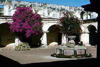 Religious Site
The Iglesia y Convento de las Capuchinas is a notable convent and church in Antigua Guatemala, Guatemala. It is one of the finest examples of an 18th-century convent in Guatemala.
Read on Wikipedia Historic
The Museo Miraflores is an archaeological museum in Guatemala City, dedicated to the display of artefacts from the ancient Maya city of Kaminaljuyu. The museum is open from Tuesday through to Sunday.The museum was founded in 2002.
Read on Wikipedia Wall painting
The Autonomous University of Campeche (in Spanish: Universidad Autónoma de Campeche, UACAM) is a Mexican public university based in the city of Campeche, Campeche, that has several campuses across the state.
Read on Wikipedia Mountain peaks
Volcán Suchitán is a stratovolcano located in Asunción Mita, Jutiapa, Guatemala.List of volcanoes in Guatemala"Suchitán". Global Volcanism Program. Smithsonian Institution.
Read on Wikipedia Architecture
Acanmul is a Maya archaeological site in the Mexican state of Campeche. It is located 25 km (16 mi) northeast of Campeche city.
Read on Wikipedia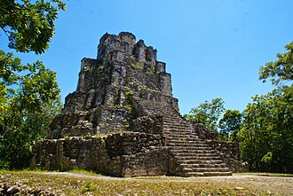 Historic
Muyil (also known as Chunyaxché) was one of the earliest and longest inhabited ancient Maya sites on the eastern coast of the Yucatan Peninsula.
Read on Wikipedia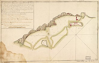 Battlefields
The Battle of Roatán (sometimes spelled "Rattan") was an American War of Independence battle fought on March 16, 1782, between British and Spanish forces for control of Roatán, an island off the Caribbean coast of present-day Honduras.A Spanish expeditionary force under Matías de Gálvez, the Cap…
Read on Wikipedia Historic
Piedras Negras is the modern name for a ruined city of the pre-Columbian Maya civilization located on the north bank of the Usumacinta River in the Petén department of northwestern Guatemala. Piedras Negras is one of the most powerful of the Usumacinta ancient Maya urban centers.
Read on Wikipedia Landmark
The Calakmul Biosphere Reserve (Spanish: Reserva de la Biósfera de Calakmul) is located at the base of the Yucatán Peninsula in Mexico, in Calakmul Municipality in the state of Campeche, bordering the Guatemalan department of El Petén to the south.
Read on Wikipedia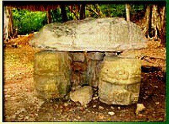 Historic
El Perú (also known as Waka'), is a pre-Columbian Maya archeological site occupied during the Preclassic and Classic cultural chronology periods (roughly 500 BC to 800 AD).
Read on Wikipedia Fortifications
Bacalar (Spanish: [bakaˈlaɾ] (listen)) is the municipal seat and largest city in Bacalar Municipality (until 2011 a part of Othón P. Blanco Municipality) in the Mexican state of Quintana Roo, about 40 kilometres (25 mi) north of Chetumal, at 18° 40' 37" N, 88° 23' 43" W.
Read on Wikipedia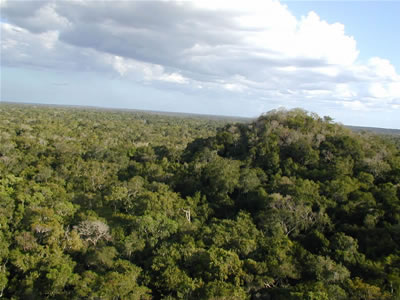 Nature
The Maya Biosphere Reserve (Spanish: Reserva de la Biosfera Maya) is a nature reserve in Guatemala managed by Guatemala's National Council of Protected Areas (CONAP). The Maya Biosphere Reserve covers an area of 21,602 km², one-fifth of the country's total land area.
Read on Wikipedia Historic
Sacul is an archaeological site of the Maya civilization located in the upper drainage of the Mopan River, in the Petén department of Guatemala. The city occupied an important trade route through the Maya Mountains. The main period of occupation dates to the Late Classic Period.
Read on Wikipedia Historic
Uaxactun (pronounced [waʃakˈtun]) is an ancient sacred place of the Maya civilization, located in the Petén Basin region of the Maya lowlands, in the present-day department of Petén, Guatemala. The site lies some 12 miles (19 km) north of the major center of Tikal.
Read on Wikipedia Historic
Cahal Pech is a Maya site located near the town of San Ignacio in the Cayo District of Belize. The site was a palatial, hilltop home for an elite Maya family, and through the most major construction dates to the Classic period, evidence of continuous habitation has been dated to as far back as 1200…
Read on Wikipedia Religious Site
Founded in 1905, St. Andrew's Church is an active Anglican congregation located on Burns Avenue in San Ignacio, Belize.
Read on Wikipedia Water
WaterBig Rock Falls is a 150-foot waterfall on Privassion River, in the Mountain Pine Ridge Forest Reserve of the Cayo District of Belize.
Read on Wikipedia Historic
Actun Tunichil Muknal (the Cave of the Crystal Sepulchre), also known locally as ATM, is a cave in Belize, near San Ignacio, Cayo District, notable as a Maya archaeological site that includes skeletons, ceramics, and stoneware. There are several areas with skeletal remains in the main chamber.
Read on Wikipedia Urban
UrbanThe Belize Zoo and Tropical Education Center is a zoo in Belize, located some 47 kilometres (29 mi) west of Belize City on the Western Highway. Set in 12 hectares (29 acres), the zoo was founded in 1983 by Sharon Matola. It is home to more than 175 animals of about 48 species, all native to Belize.
Read on Wikipedia Architecture
Tikal Temple 33 (referred to in archaeological reports as 5D-33) was a 33-metre-high (108 ft) ancient Maya funerary pyramid located in the North Acropolis of the great Maya city of Tikal.
Read on Wikipedia Religious Site
Tikal Temple I is the designation given to one of the major structures at Tikal, one of the largest cities and archaeological sites of the pre-Columbian Maya civilization in Mesoamerica. It is located in the Petén Basin region of northern Guatemala.
Read on Wikipedia Viewpoint
Tikal Temple II (or the Temple of the Masks, alternatively labelled by archaeologists as Tikal Structure 5D-2) is a Mesoamerican pyramid at the Maya archaeological site of Tikal in the Petén Department of northern Guatemala.
Read on Wikipedia Landmark
Bladen Nature Reserve is a landscape of caves, sinkholes, pristine streams and rivers, undisturbed old growth rainforest and an abundance of highly diverse flora and fauna which includes a great deal of rare and endemic species.
Read on Wikipedia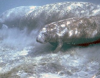 Landmark
The Chocón Machacas Protected Biotope is a protected nature reserve in eastern Guatemala. It is located in the municipality of Livingston, in a densely forested area covering the lower reaches of the Chocón Machacas River basin and the northern shores of the Río Dulce-Golfete Dulce system ( 15.75…
Read on Wikipedia Park
ParkDulce River (Spanish: Río Dulce, or "Sweet River") is a river in Guatemala, completely contained within the department of Izabal. It is part of a lake and river system that has become a popular cruising sailboat destination.The river begins at the point where it flows out of Lake Izabal.
Read on WikipediaBacalar Chico National Park and Marine Reserve (BCNPMR) is a protected area and UNESCO World Heritage Site on the northern part of Ambergris Caye in Belize.
Read on WikipediaThe Sierra del Lacandón is a low karstic mountain range in Guatemala and Mexico. It is situated in the north-west of the department of El Petén and the south-east of Chiapas.
Read on WikipediaThe Motagua Valley thornscrub ecoregion (WWF ID#NT1312) is located in the Motagua valley in eastern Guatemala. Surrounded by mountains and receiving relatively little precipitation, the valley is one of the driest in Central America and is characterized by thorn scrub vegetation.
Read on WikipediaCerro Miramundo, also known as Montaña de la Soledad, is a hill covered with dry shrubland located a few kilometers south of the city of Zacapa in Guatemala.
Read on WikipediaLos Naranjos is the name for an archaeological region in western Honduras. It lies on the north border of Lake Yojoa. It is significant to the region because of its implications on determining where the Mayan frontier existed, as well as which ancient peoples were in contact and what relations betwe…
Read on WikipediaMontaña Santa Bárbara National Park (previously named Santa Bárbara National Park) is a national park in Honduras. It was established on 1 January 1987 and covers an area of 121.3 square kilometres.
Read on WikipediaLaguna del Tigre National Park is located in northern Guatemala, in the municipality of San Andrés, Petén Department. Covering an area of 337,899 ha, makes it the largest core zone of the Maya Biosphere Reserve (MBR) and the largest national park in Guatemala and the largest protected wetlands in…
Read on WikipediaCuevas del Silvino is a limestone cave system in Guatemala. It is located at km 260 on the road connecting Guatemala City to Puerto Barrios, in the municipality of Morales in the department of Izabal.The Silvino cave system was declared a national park in 1972.
Read on WikipediaItzan is a Maya archaeological site located in the municipality of La Libertad in the Petén Department of Guatemala. Various small structures at the site were destroyed in the 1980s during oil exploration activities by Sonpetrol and Basic Resources Ltd, prompting rescue excavations by archaeologist…
Read on WikipediaArroyo de Piedra is a pre-Columbian Maya archaeological site in Guatemala located approximately 2-3 km east/northeast of Dos Pilas and 3 km west of Tamarindito. The site dates to the middle half of the Classic period.
Read on WikipediaTres Islas (Spanish for "Three Islands") is a small pre-Columbian Maya archaeological site 20 kilometres (12 mi) north of Cancuen in Petén Department, northern Guatemala.
Read on WikipediaThe Drums of Our Fathers Monument, located at the entrance of Dangriga, Stann Creek, Belize, is a monument designed by the Nigerian sculptor Stephen Okeke, honoring Garifuna history, culture and its beliefs.
Read on WikipediaSt. Martin de Porres Catholic Church is a Roman Catholic parish on the southwest side of Belize City, Belize, Central America.In 1968 Jesuit Fr. Bill Messmer, pastor of St. Ignatius Church in South Belize City, opened a school to accommodate students in the west part of his parish. Jesuit Fr.
Read on WikipediaBelize is a country on the north-eastern coast of Central America. It is bordered by Mexico to the north, the Caribbean Sea to the east, and Guatemala to the west and south. It also shares a maritime boundary with Honduras to the southeast. Part of the Caribbean region, Belize is a member of the Caribbean Community (CARICOM) and the Commonwealth Caribbean, the historical British West Indies.
Read on WikipediaStay connected with an affordable eSIM plan — instant activation, no roaming fees.
View eSIM Plans for BelizeAttraction data from OpenTripMap & OpenStreetMap