
Nicaragua
Hol dir sofortiges mobiles Datenvolumen mit unseren Premium-eSIM-Plänen. Keine physische SIM-Karte nötig, einfach scannen und loslegen.
5Verfügbare Pakete
NI 1 GB / 7 Days
4G/LTE
1 GB
Daten inklusive
7 Tage
Gültigkeitsdauer
Netzwerk
NI 3 GB / 30 Days
4G/LTE
3 GB
Daten inklusive
30 Tage
Gültigkeitsdauer
Netzwerk
NI 5 GB / 30 Days
4G/LTE
5 GB
Daten inklusive
30 Tage
Gültigkeitsdauer
Netzwerk
NI 10 GB / 30 Days
4G/LTE
10 GB
Daten inklusive
30 Tage
Gültigkeitsdauer
Netzwerk
NI 20 GB / 30 Days
4G/LTE
20 GB
Daten inklusive
30 Tage
Gültigkeitsdauer
Netzwerk
Entdecke Nicaragua
Überblick
Nicaragua, officially the Republic of Nicaragua, is the geographically largest country in Central America, comprising 130,370 square kilometers (50,340 sq mi). With a population of 7,142,529 as of 2024, it is the third-most populous country in Central America after Guatemala and Honduras, and it is the largest by area in all of Central America.
Auf Wikipedia lesenReisetipps
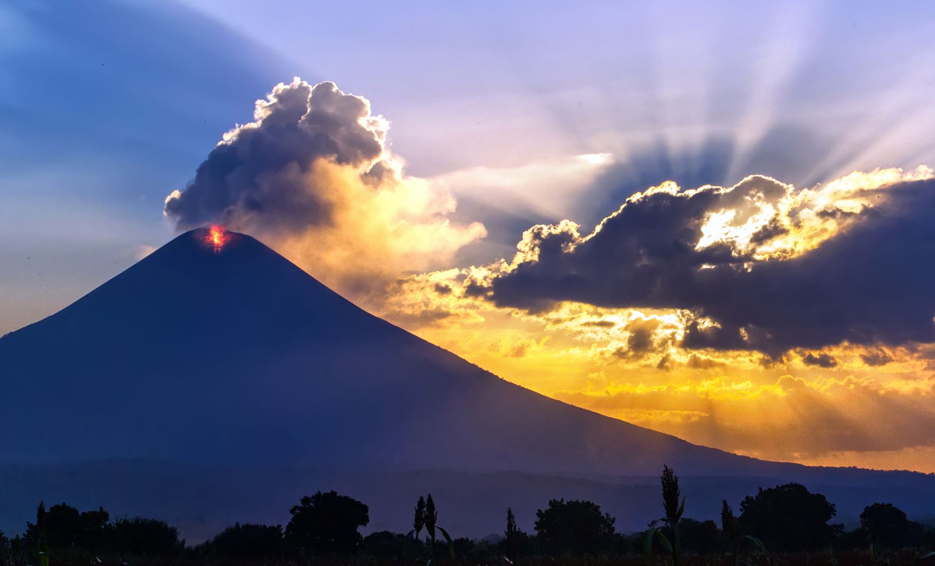
Nicaragua is the largest country in Central America by area and the least densely populated. Nicaraguans like to refer to their country as the "país de lagos y volcanes"; the country of lakes and volcanoes. And those are indeed striking features as Nicaragua contains the largest freshwater body in Central America, Lake Nicaragua or Cocibolca. Inside Lake Nicaragua the famed Volcano Concepcion on Ometepe rises to about a mile in altitude, but other volcanoes such as Momotombo or Mombacho are also impressive.
Reiseführer auf WikivoyageDaten von Wikipedia, Wikivoyage & REST Countries
Top-Sehenswürdigkeiten in Nicaragua
Orte und Wahrzeichen, die man gesehen haben muss
 Park
ParkReserva Silvestre Privada Montecristo
The San Juan River (Spanish: Río San Juan), also known as El Desaguadero ("the drain"), is a 192-kilometre (119 mi) river that flows east out of Lake Nicaragua into the Caribbean Sea. A large section of the border between Nicaragua and Costa Rica runs on the southern bank of the river.
 Mountain peaks
Orosí Volcano
The Orosí Volcano, in Spanish the Volcán Orosí, is an inactive volcano in Costa Rica, situated in the Cordillera de Guanacaste near the border with Nicaragua.
 Landmark
Junquillal Bay Wildlife Refuge
Junquillal Bay Wildlife Refuge, also called the Bahia Junquillal National Wildlife Refuge, is a 4.38 km2 (1.69 sq mi) wildlife refuge in Guanacaste Province of northwestern Costa Rica.It is a part of the Guanacaste Conservation Area and the Area de Conservación Guanacaste World Heritage Site.It pro…
 Landmark
Tepesomoto-Pataste Natural Reserve
Tepesomoto-Pataste Natural Reserve (Spanish: Reserva Natural Tepesomoto Pataste) is a nature reserve in Nicaragua. It is one of the 78 reserves that are under official protection in the country.The reserve covers the mountain ridge running from Tepesomoto Volcano overlooking Somoto in the north, to…
 Mountain peaks
Maderas
With a height of 1,394 metres (4,573 ft), Maderas is the smaller of the two which make up the island of Ometepe, situated in Lake Nicaragua in Nicaragua, Central America. Unlike Concepción, the other volcano on the island, Maderas has not been active in historical times.
 Religious Site
Roman Catholic Diocese of Jinotega
The Roman Catholic Diocese of Jinotega (erected 18 June 1982, as the Territorial Prelature of Jinotega) is a suffragan of the Archdiocese of Managua. It was elevated on 30 April 1991.Pedro Lisímaco de Jesús Vílchez Vílchez (1982–2005) Carlos Enrique Herrera Gutiérrez, O.F.M.
 Mountain peaks
Peña of Cross
 Mountain peaks
Mombacho
Mombacho is a stratovolcano in Nicaragua, near the city of Granada. It is 1,344 metres (4,409 ft) high. The Mombacho Volcano Nature Reserve is one of 78 protected areas of Nicaragua. Mombacho is an extinct volcano, but the last eruption occurred in 1570.
 Mountain peaks
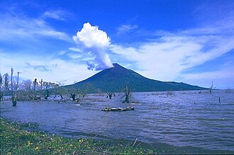
Volcano Momotombo
Momotombo is a stratovolcano in Nicaragua, not far from the city of León. It stands on the shores of Lago de Managua. An eruption of the volcano in 1610 forced inhabitants of the Spanish city of León to relocate about 48 km (30 mi) west.
 Religious Site
Granada Cathedral
The Our Lady of the Assumption Cathedral (Spanish: Catedral de Nuestra Señora de la Asunción) also called Granada Cathedral is a neoclassical Catholic cathedral located in Granada, Nicaragua, 40 kilometres (25 mi) southeast of Managua.
 Mountain peaks
Isla Zacate Grande
Isla Zacate Grande is a stratovolcano in Honduras. The volcano forms a 7 by 10 km (4 by 6 mi) island in the Gulf of Fonseca and has seven satellite cones, including Guegensi Island located 3 km (2 mi) from Zacate Grande.
 Urban
UrbanRincón de la Vieja Volcano National Park
Rincón de la Vieja National Park (Spanish: Parque Nacional Rincón de la Vieja), is a National Park in Guanacaste Province of the northwestern part of Costa Rica.It encompasses the Rincón de la Vieja and Santa María volcanoes, as well as the dormant Cerro Von Seebach.
Daten von OpenTripMap & OpenStreetMap
Entdecken Sie nahegelegene Ziele
Beliebte eSIM-Tarife in der gleichen Region


Warum unsere eSIM wählen?
Sofortige Aktivierung
Erhalte deinen eSIM QR-Code sofort nach dem Kauf.
Bleib verbunden
Highspeed-Daten in lokalen Netzwerken.
Keine versteckten Gebühren
Transparente Preise. Keine Überraschungen.