
Eritrea
Hol dir sofortiges mobiles Datenvolumen mit unseren Premium-eSIM-Plänen. Keine physische SIM-Karte nötig, einfach scannen und loslegen.
Keine Pläne verfügbar
Schau später wieder vorbei für verfügbare Datenpläne für Eritrea
Andere Reiseziele durchsuchenEntdecke Eritrea
Überblick
Eritrea, officially the State of Eritrea, is a country in the Horn of Africa region of East Africa. Its capital and largest city is Asmara. The country is bordered by Ethiopia to the south, Sudan to the west, and Djibouti to the southeast. The northeastern and eastern parts of Eritrea have an extensive coastline along the Red Sea. The country has a total area of approximately 117,600 km2 (45,406 sq mi), and includes the Dahlak Archipelago and several of the Hanish Islands.
Auf Wikipedia lesenReisetipps
Eritrea is a country in East Africa. Formerly an Italian colony, the country shares a common language and culture with its large neighbour, Ethiopia, which it was once a part of until Eritrea gained its independence in 1993. It used to be Africa's youngest country until 2011, which was when South Sudan gained its independence.
Reiseführer auf WikivoyageDaten von Wikipedia, Wikivoyage & REST Countries
Top-Sehenswürdigkeiten in Eritrea
Orte und Wahrzeichen, die man gesehen haben muss
 Mountain peaks
Mousa Ali
Mousa Ali (Arabic: موسى علي) is a 2,021 metres (6,631 ft) stratovolcano located on the tri-point of Ethiopia, Eritrea and Djibouti. The volcano is the highest point in Djibouti. The volcano's summit is truncated by a caldera, which contains rhyolitic lava domes and lava flows.
 Battlefields
First and Second Battles of El Teb
The First and Second Battles of El Teb (February 4, 1884 and February 29, 1884) took place during the British Sudan Campaign where a force of Sudanese under Osman Digna won a victory over a 3500 strong Egyptian force under the command of General Valentine Baker which was marching to relieve Tokar on…
 Mountain peaks
Asavyo
Asavyo also known as Bara Ale is a large silicic stratovolcano in Ethiopia, which forms part of the Bidu Volcanic complex. It lies about 20 km southwest from the Nabro and Mallahle volcanoes. Asavyo has a 12 km wide caldera.
 Mountain peaks
Mallahle
Mallahle (also Mallali or Aruku) is a stratovolcano on the border of Ethiopia and Eritrea, with a 6 km wide caldera.Mallahle is the highest peak in the Afdera region of Ethiopia. It is located in the Danakil Horst at the southern end of the Danakil Alps.
Mountain peaksMount Sarkali
Sork Ale (also known as Asdaga or Sorcali) is a sicilic stratovolcano located in the Danakil Horst at the southern end of the Danakil Alps near the Ethiopia/Eritrea border.
 Mountain peaks
Nabro Volcano
The Nabro Volcano is an active stratovolcano in the Southern Red Sea Region of Eritrea. It is located at the south-east end of the Danakil Alps in the Danakil Depression.
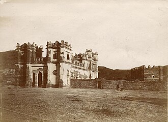
 Religious Site
Debre Birhan Selassi Church
 Mountain peaks
Afdera
Afdera is an isolated stratovolcano in northeastern Ethiopia, located at the intersection of three fault systems between the Erta Ale, Tat Ali, and Alayta mountain ranges.There have been reports of the volcano erupting in 1907 and 1915 but morphological evidence cannot substantiate these claims.
Mountain peaksAlayta
Mount Alayta is an active shield volcano in the Afar Region of Ethiopia. It is part of the Afar Triangle (Afar Depression), a highly active volcanic region which includes the adjacent Mount Afdera. Mount Alayta covers an area of 2,700 square kilometers southwest of Lake Afrera.
 Mountain peaks
Amba Aradam
Amba Aradam is a table mountain in northern Ethiopia. Located in the Debub Misraqawi (Southeastern) Zone of the Tigray Region, between Mek'ele and Addis Abeba, it has a latitude and longitude of 13°20′N 39°31′E and an elevation of 2,756 metres (9,042 ft).The name in Tigrinya is Imba Aradom, bu…
 Battlefields
Battle of Mek'ele
The Battle of Mekelle, sometimes known as the siege of Mekelle, took place in January 1896 during the First Italo-Ethiopian War.
 Landmark
Gaet'ale Pond
Gaet'ale Pond is a small hypersaline lake located near the Dallol crater in the Danakil Depression (Afar, Ethiopia). It is located over a hot spring of tectonic origin and has no apparent inlet or outlet streams.
Daten von OpenTripMap & OpenStreetMap
Entdecken Sie nahegelegene Ziele
Beliebte eSIM-Tarife in der gleichen Region


Warum unsere eSIM wählen?
Sofortige Aktivierung
Erhalte deinen eSIM QR-Code sofort nach dem Kauf.
Bleib verbunden
Highspeed-Daten in lokalen Netzwerken.
Keine versteckten Gebühren
Transparente Preise. Keine Überraschungen.