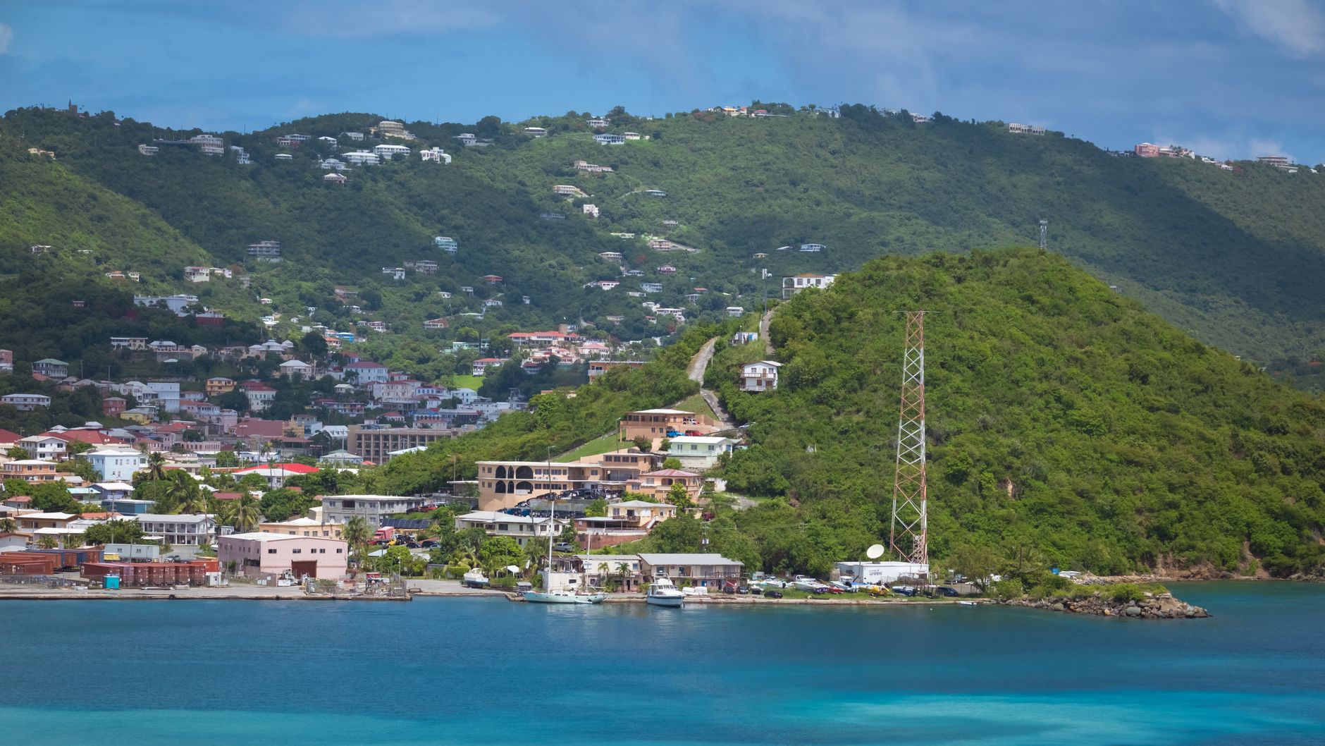

Dominica
Hol dir sofortiges mobiles Datenvolumen mit unseren Premium-eSIM-Plänen. Keine physische SIM-Karte nötig, einfach scannen und loslegen.
5Verfügbare Pakete
DM 1 GB / 7 Days
4G/LTE
1 GB
Daten inklusive
7 Tage
Gültigkeitsdauer
Netzwerk
DM 3 GB / 30 Days
4G/LTE
3 GB
Daten inklusive
30 Tage
Gültigkeitsdauer
Netzwerk
DM 5 GB / 30 Days
4G/LTE
5 GB
Daten inklusive
30 Tage
Gültigkeitsdauer
Netzwerk
DM 10 GB / 30 Days
4G/LTE
10 GB
Daten inklusive
30 Tage
Gültigkeitsdauer
Netzwerk
DM 20 GB / 30 Days
4G/LTE
20 GB
Daten inklusive
30 Tage
Gültigkeitsdauer
Netzwerk
Entdecke Dominica
Überblick
Dominica, officially the Commonwealth of Dominica, is an island country in the Caribbean. It is part of the Windward Islands chain in the Lesser Antilles archipelago in the Caribbean Sea. The capital, Roseau, is located on the western side of the island. Dominica's closest neighbours are two constituent territories of the European Union, both overseas departments of France: Guadeloupe to the northwest and Martinique to the south-southeast.
Auf Wikipedia lesenReisetipps
Dominica is a Caribbean island country. It is referred to as the "Nature Island of the Caribbean" due to its spectacular, lush, and varied flora and fauna, which are protected by an extensive national park system. The most mountainous island of the Lesser Antilles, its volcanic peaks are cones of lava craters and include Boiling Lake, the second-largest thermally active lake in the world.
Reiseführer auf WikivoyageDaten von Wikipedia, Wikivoyage & REST Countries
Top-Sehenswürdigkeiten in Dominica
Orte und Wahrzeichen, die man gesehen haben muss
 Historic
Gravure Rupestres
 Architecture
Habitation La Grivelière
Habitation La Grivelière ('Grivelière House) is a coffee plantation and coffeehouse in Vieux-Habitants, Basse-Terre, Guadeloupe, an overseas region of France. Founded in the late 17th century, it has been classified as a Monument historique since 1987.
 Religious Site
Co-Cathedral of Our Lady of Assumption, Saint-Pierre
The Co-Cathedral of Our Lady of Assumption (French: Cathédrale Notre-Dame-de-l'Assomption de Saint-Pierre de la Martinique) or simply Cathedral of Our Lady of the Assumption, is the co-cathedral church of the Archdiocese of Fort-de-France, is located in Saint-Pierre, on the island of Martinique, a…
 Fortifications
Fort Saint-Louis
Fort Saint Louis (often hyphenated as Fort Saint-Louis) is a seaside fortress in Fort-de-France, Martinique. The present-day fort has evolved from earlier strongholds that were erected on the site as early as 1638, and has been known in previous incarnations as Fort Royal and Fort de la Republique.
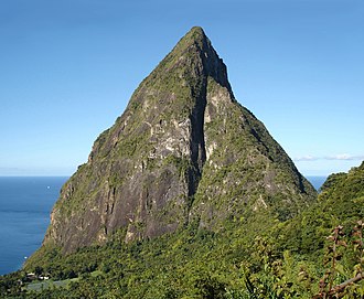
 Mountain peaks
Gros Piton
The Pitons are two mountainous volcanic plugs, volcanic spires, located in Saint Lucia. Gros Piton is 798.25 m (2,618.9 ft) high, and Petit Piton is 743 m (2,438 ft) high; they are linked by the Piton Mitan ridge.
 Mountain peaks
Qualibou
Qualibou, also known as the Soufrière Volcanic Center, is a 3.5 X 5 km wide caldera on the island of Saint Lucia that formed approximately 32–39,000 years ago.
 Other
OtherLesser Antillean dry forests
The Lesser Antillean dry forests ecoregion (WWF ID:NT0220) covers the dry forests of the coastal lowlands of the Lesser Antilles, where the eastern Caribbean Sea meets the Atlantic Ocean.
 Mountain peaks
Petit Piton
The Pitons are two mountainous volcanic plugs, volcanic spires, located in Saint Lucia. Gros Piton is 798.25 m (2,618.9 ft) high, and Petit Piton is 743 m (2,438 ft) high; they are linked by the Piton Mitan ridge.
 Nature
Petite Terre Islands National Nature Reserve
Petite Terre Islands National Nature Reserve (French: Réserve naturelle nationale des îles de la Petite-Terre) is a reserve of the Petite Terre Islands in Guadeloupe. The reserve was established by Decree No. 98-801 of 3 September 1998 as the nature reserve for the islands of Petite Terre.
 Rock formations
Les Roches percées
The Îles des Saintes ([il de sɛ̃t]; "Islands of the Female Saints"), also known as Les Saintes, is a group of small islands in the archipelago of Guadeloupe, an overseas department of France.
 Mountain peaks
Pain de Sucre
The Îles des Saintes ([il de sɛ̃t]; "Islands of the Female Saints"), also known as Les Saintes, is a group of small islands in the archipelago of Guadeloupe, an overseas department of France.
 Nature
Pompierre
The Plage de Pompierre is a beach of Terre-de-Haut, one of two islands in the archipelago of the Îles des Saintes in the French Antilles. It is 800 metres long, and overlooks Pompierre Bay on the northeast coast of the island, and is protected from the trade winds by the presence of an islet.
Daten von OpenTripMap & OpenStreetMap
Entdecken Sie nahegelegene Ziele
Beliebte eSIM-Tarife in der gleichen Region


Warum unsere eSIM wählen?
Sofortige Aktivierung
Erhalte deinen eSIM QR-Code sofort nach dem Kauf.
Bleib verbunden
Highspeed-Daten in lokalen Netzwerken.
Keine versteckten Gebühren
Transparente Preise. Keine Überraschungen.