
Bolivien
Hol dir sofortiges mobiles Datenvolumen mit unseren Premium-eSIM-Plänen. Keine physische SIM-Karte nötig, einfach scannen und loslegen.
5Verfügbare Pakete
BO 512 MB / 7 Days
4G/LTE
512 MB
Daten inklusive
7 Tage
Gültigkeitsdauer
Netzwerk
BO 3 GB / 15 Days
4G/LTE
3 GB
Daten inklusive
15 Tage
Gültigkeitsdauer
Netzwerk
BO 5 GB / 30 Days
5G
5 GB
Daten inklusive
30 Tage
Gültigkeitsdauer
Netzwerk
BO 10 GB / 30 Days
5G
10 GB
Daten inklusive
30 Tage
Gültigkeitsdauer
Netzwerk
BO 20 GB / 30 Days
4G/LTE
20 GB
Daten inklusive
30 Tage
Gültigkeitsdauer
Netzwerk
Entdecke Bolivien
Überblick
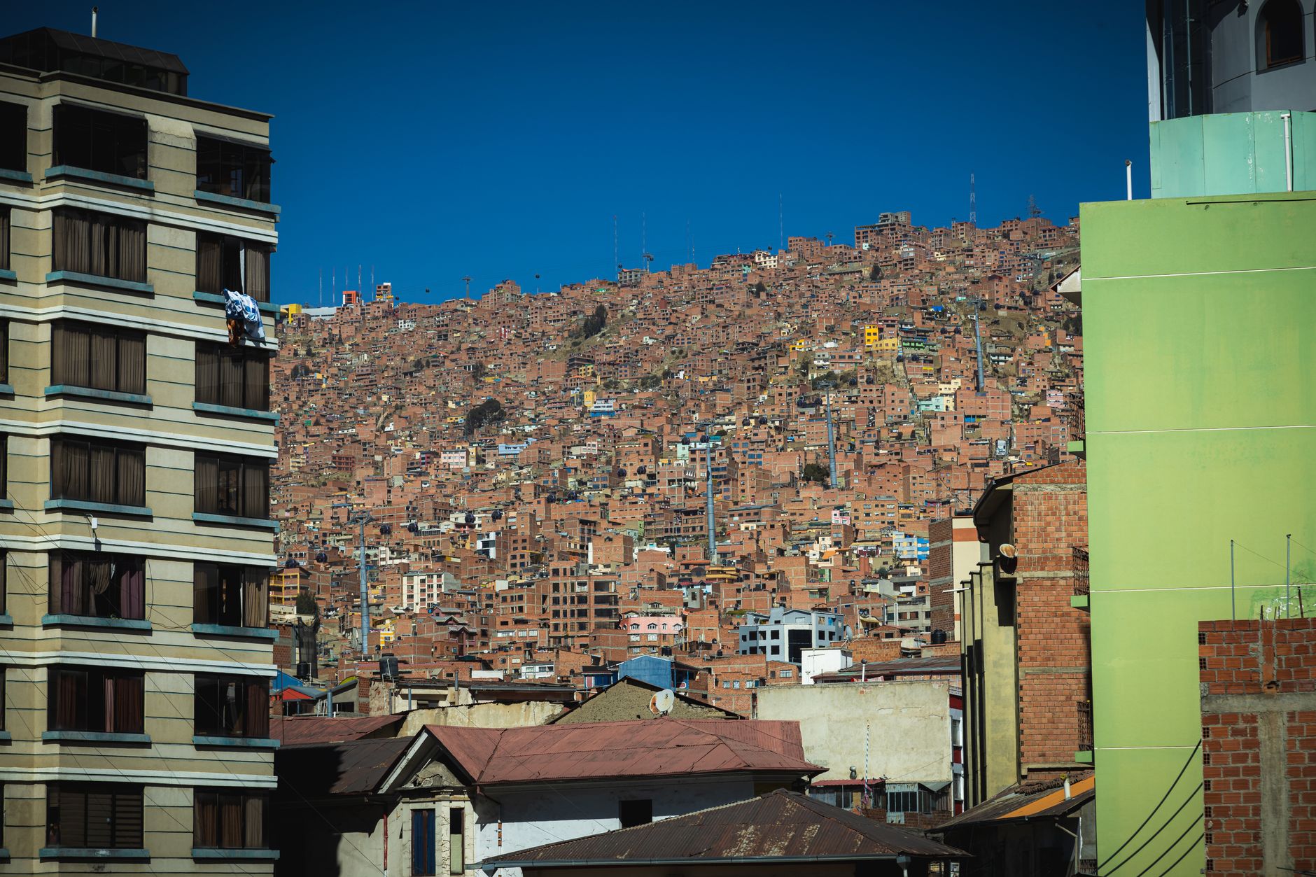
Bolivia, officially the Plurinational State of Bolivia, is a landlocked country located in central South America. Its geography primarily consists of an Andean region to the west and tropical lowlands to the east and north. The country has a diverse environment, including the vast Amazonian plain, the Gran Chaco, temperate valleys, the high-altitude Altiplano plateau, snow-capped peaks, and mountains, encompassing a wide range of climates and biomes across its regions and cities.
Auf Wikipedia lesenReisetipps
Bolivia is a beautiful, geographically rich, and multiethnic country in the heart of South America, visited for its stunning mountain landscapes and vibrant indigenous culture.
Reiseführer auf WikivoyageDaten von Wikipedia, Wikivoyage & REST Countries
Top-Sehenswürdigkeiten in Bolivien
Orte und Wahrzeichen, die man gesehen haben muss
 Mountain peaks
Cerro Chorolque
Chorolque also known as Cerro Chorolque is an extinct volcano in the Potosí Department of the Southern Bolivia. The Santa Bárbara settlement is located at a height of 4800 m on the side of the mountain.Mining has led to drastic changes in the slope on all sides of the mountain.
 Historic
José de San Martín
José Francisco de San Martín y Matorras (25 February 1778 – 17 August 1850), known simply as José de San Martín (Spanish pronunciation: [xoˈse ðe san maɾˈtin] (listen)) or the Liberator of Argentina, Chile and Peru, was an Argentine general and the primary leader of the southern and centra…
 Historic
Juan José Torres
Juan José Torres González (5 March 1920 – 2 June 1976) was a Bolivian socialist politician and military leader who served as the 50th President of Bolivia from 1970 to 1971, when he was ousted in a US-supported coup that resulted in the dictatorship of Hugo Banzer.
 Historic
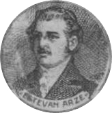
Esteban Mariano Arze Alba y Uriona
 Mountain peaks
Sirk'i
Sirk'i (Aymara for wart, also spelled Serkhe) is a 4,962-metre-high (16,280 ft) mountain in the Andes of Bolivia east of Poopó Lake. It is located in the Oruro Department, Sebastián Pagador Province, which is identical to the Santiago de Huari Municipality.
Mountain peaksChullpa
Chullpa (Aymara for an ancient funerary building (chullpa)) is a 4,307-metre-high (14,131 ft) mountain in the Andes of Bolivia east of Poopó Lake. It is located in the Oruro Department, Sebastián Pagador Province, which is identical to the Santiago de Huari Municipality.
Mountain peaksCh'alla Phujru
Ch'alla Phujru (Aymara ch'alla sand, phujru a hole or pit in the earth without water, not very deep, "sand hole", also spelled Challa Phujru) is a 4,904-metre-high (16,089 ft) mountain in the Andes of Bolivia east of Poopó Lake.
Mountain peaksChullpiri
Chullpiri (Aymara chullpa an ancient funerary building, -(i)ri a suffix) is a 5,018-metre-high (16,463 ft) mountain in the Andes of Bolivia east of Poopó Lake. It is located in the Oruro Department, Sebastián Pagador Province, which is identical to the Santiago de Huari Municipality.
 Battlefields
Battle of Vilcapugiou
The Battle of Vilcapugio (Quechua: Sacred Well) was an action fought on October 1, 1813 during the second Campaign of Upper Peru in the Argentine War of Independence, where the republican forces led by General Manuel Belgrano were defeated by a royalist army, led by Joaquin de la Pezuela.After the A…
 Mountain peaks
Suchusqa
Suchusqa (Quechua suchuy to slide, -sqa a suffix, "slidden", also spelled Suchuskha) is a mountain in the Bolivian Andes which reaches a height of approximately 4,280 m (14,040 ft). It is located in the Potosí Department, Antonio Quijarro Province, Porco Municipality, southwest of Porco.
 Nature
El Palmar Integrated Management Natural Area
El Palmar Integrated Management Natural Area (Área Natural de Manejo Integrado El Palmar) - not to be confused with El Palmar National Park in Argentina - is a protected area in Bolivia located in the Chuquisaca Department, Jaime Zudáñez Province.www.fundesnap.org / El Palmar Integrated Managemen…
 Historic
Marcelo Quiroga Santa Cruz
Marcelo Quiroga Santa Cruz (13 March 1931 – 17 July 1980) was a noted writer, dramatist, journalist, social commentator, university professor, and socialist political leader from Bolivia.
Daten von OpenTripMap & OpenStreetMap
Entdecken Sie nahegelegene Ziele
Beliebte eSIM-Tarife in der gleichen Region


Warum unsere eSIM wählen?
Sofortige Aktivierung
Erhalte deinen eSIM QR-Code sofort nach dem Kauf.
Bleib verbunden
Highspeed-Daten in lokalen Netzwerken.
Keine versteckten Gebühren
Transparente Preise. Keine Überraschungen.