
Burundi
Hol dir sofortiges mobiles Datenvolumen mit unseren Premium-eSIM-Plänen. Keine physische SIM-Karte nötig, einfach scannen und loslegen.
Keine Pläne verfügbar
Schau später wieder vorbei für verfügbare Datenpläne für Burundi
Andere Reiseziele durchsuchenEntdecke Burundi
Überblick
Burundi, officially the Republic of Burundi, is a landlocked country in East Africa. It is located in the Great Rift Valley at the junction between the African Great Lakes region and Southeast Africa, with a population of over 14 million people. It is bordered by Rwanda to the north, Tanzania to the east and southeast, and the Democratic Republic of the Congo to the west; Lake Tanganyika lies along its southwestern border.
Auf Wikipedia lesenReisetipps
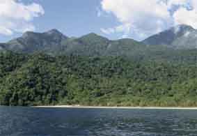
Burundi is a small country in East Africa, although it has some cultural and geographical ties with Central Africa. It is surrounded by Rwanda, Tanzania and the Democratic Republic of the Congo. Although the country is rich in culture and history, the country has been in a state of instability since gaining independence in the 1960s. Burundi is one of the world's poorest and least developed countries and has a myriad of social, political, and economic problems.
Reiseführer auf WikivoyageDaten von Wikipedia, Wikivoyage & REST Countries
Top-Sehenswürdigkeiten in Burundi
Orte und Wahrzeichen, die man gesehen haben muss
 Park
ParkKatavi National Park
Katavi National Park is a Tanzanian national park created in 1974 and is located in Katavi Region, Tanzania. It is a very remote park that is less frequently visited than other Tanzanian national parks.
 Mountain peaks
Mount Mikeno
Mount Mikeno is an extinct volcanic mountain located in the Democratic Republic of the Congo section of the Virunga Mountains along with Mount Nyiragongo, Mount Nyamuragira, Mount Karisimbi, Mount Bisoke and Mount Sabyinyo.
 Mountain peaks
Nyiragongo
Mount Nyiragongo ( neer-ə-GONG-go) is an active stratovolcano with an elevation of 3,470 m (11,385 ft) in the Virunga Mountains associated with the Albertine Rift.
 Urban
UrbanNyungwe Forest National Park
The Nyungwe Forest () is located in southwestern Rwanda, on the border with Burundi, where it is contiguous with the Kibira National Park to the south, and Lake Kivu and the Democratic Republic of the Congo to the west.
 Museum
Inzu ndangamurage y'Umwami
 Historic
Murambi genocide memorial
The Murambi Technical School, now known as the Murambi Genocide Memorial Centre, is situated near the town of Murambi in southern Rwanda.This memorial center is one of six major centres in Rwanda that commemorate the Rwandan genocide.
 Other
OtherRwenzori - altotropical grassland
The Ruwenzori-Virunga montane moorlands is a montane grasslands and shrublands ecoregion of central Africa.The ecoregion lies above 3000 meters elevation, and is divided into two areas: the Rwenzori Mountains on the border of Uganda and the Democratic Republic of the Congo, and the volcanic Virunga…
 Mountain peaks
Mount Baker
Mount Baker or Kiyanja is a mountain in the Rwenzori Mountains National Park in Uganda, 2.8 kilometres (1.7 mi) from the border with the Democratic Republic of the Congo. With a height of 4,844 metres (15,892 ft), it is the sixth highest mountain in Africa.
 Urban
UrbanMahale National Park
Mahale Mountains National Park lies on the eastern shore of Lake Tanganyika in Kigoma Region, Tanzania. Named after the Mahale Mountains range that is within its borders, the park has several unusual characteristics. First, it is one of only two protected areas for chimpanzees in the country.
 Mountain peaks
Nyamuragira
Nyamuragira, also known as Nyamulagira, is an active shield volcano in the Virunga Mountains of the Democratic Republic of the Congo, situated about 25 kilometres (16 mi) north of Lake Kivu.
 Cultural
Ethnographic Museum
The Ethnographic Museum (Kinyarwanda: Inzu ndangamurage), formerly the National Museum of Rwanda (French: Musée national du Rwanda, Kinyarwanda: Ingoro y'Umurage w'u Rwanda), is a national museum in Rwanda. It is located in Butare.
 Park
ParkRusizi National Park
Rusizi Nature Reserve is a nature reserve in Burundi, next to the Rusizi River. It is 15 km north of the city of Bujumbura and home to hippopotamuses and sitatungas. Gustave, a Nile crocodile rumored to have killed 300 people lives here.BirdLife International (2020).
Daten von OpenTripMap & OpenStreetMap
Entdecken Sie nahegelegene Ziele
Beliebte eSIM-Tarife in der gleichen Region


Warum unsere eSIM wählen?
Sofortige Aktivierung
Erhalte deinen eSIM QR-Code sofort nach dem Kauf.
Bleib verbunden
Highspeed-Daten in lokalen Netzwerken.
Keine versteckten Gebühren
Transparente Preise. Keine Überraschungen.